Illustrated Maps

project gallery

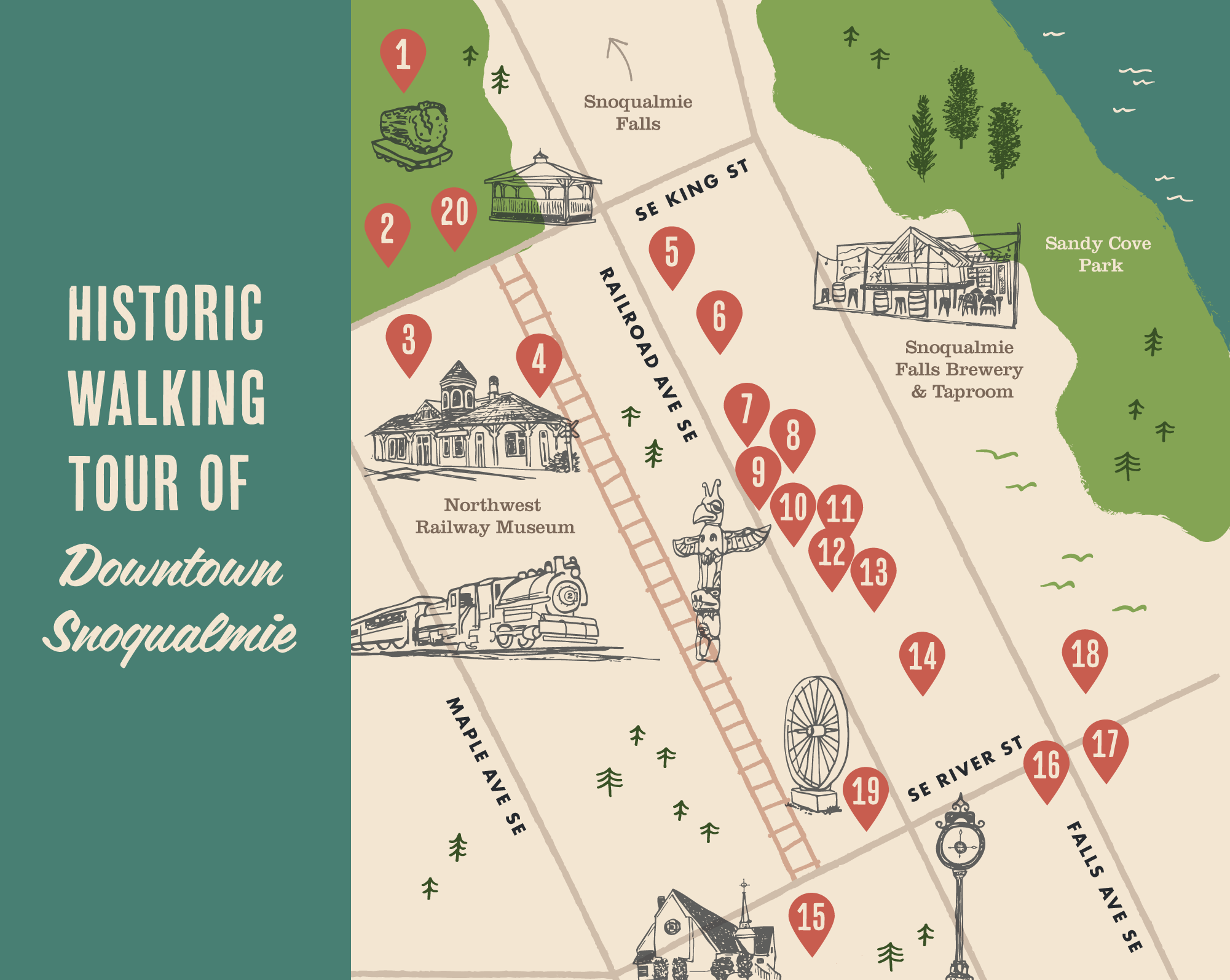
Walking tour map designs for the City of Snoqualmie

featured project

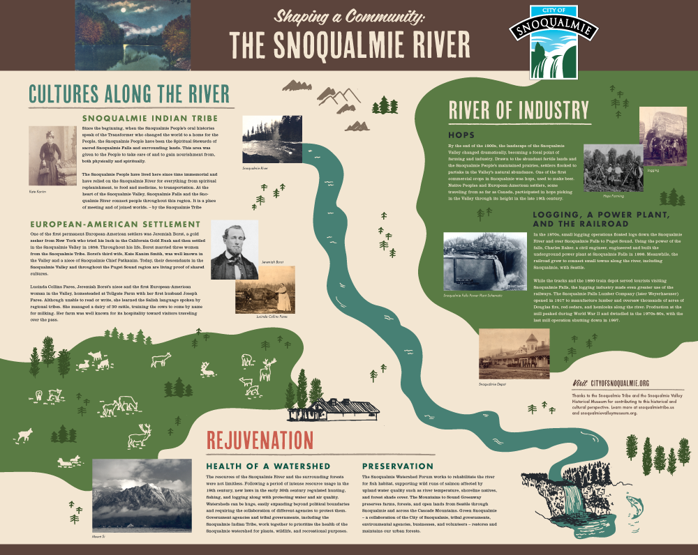
This poster series showcases diverse cultures, natural places, historic sites and local businesses in downtown Snoqualmie. They are displayed in a kiosk next to the iconic Snoqualmie Train Depot.

art direction: Gail Folkins, City of Snoqualmie

Information kiosk titled 'Historic Snoqualmie' with details about the Snoqualmie River, its historical significance, and a walking tour map of Downtown Snoqualmie. The design features hand drawn illustrations and a map design by Kat Marshello

Award winner!

this design won an Award of Excellence in The Blue Pencil & Gold Screen Awards

Map of Seattle featuring neighborhoods and landmarks including Ballard, Queen Anne, South Lake Union, Capitol Hill, Madrona, West Seattle, High Point Farm Stand, New Holly Farm Stand, Rainier Beach, Columbia City, Harborview Farm Stand, Pioneer Square, First Hill, and others, with green areas representing parks and water bodies surrounding the city.
Sketchy Line drawing of a farmers market booth with various vegetables in display bins for purchase
Green cursive text that reads "eat local".

Map of Seattle farmers markets | client: Fresh Bucks, City of Seattle

Map of Oregon with locally grown and foraged produce | client: Farm Spirit

colorful Illustrated topographic style map of the Snoqualmie Valley area showing the landscape as forest, rural, agricultural and urban spaces

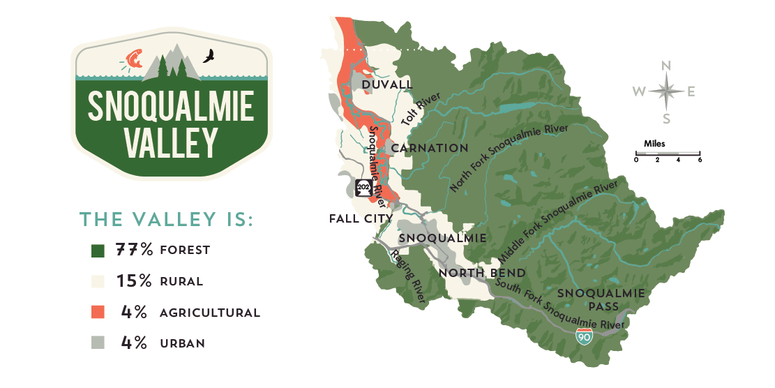
map of the Snoqualmie Valley from an infographic-style annual report | client: Mountains to Sound Greenway Trust

Wedding invitation with a map of Austin, Texas, showing landmarks and roads, placed on a brown surface with gold confetti, accompanied by a blue envelope and a small yellow flower.

map for a custom wedding invitation suite

View more projects with maps: